
|
Engelberg-Titlis Erlebnis Karte / Experience Map 2024 3 Panoramakarten vierfarbig / panoramic maps in four-color printing, 9 Abbildungen vierfarbig / illustrations in four-color printing, mit Linienplan und Fahrplan 15. April - 24. November 2023 der EAB, 64,7 x 31,4 cm, gefaltet auf / folded 7,2 x 10,5 cm deutscher und englischer Text / Text in German and English Faltblatt / leaflet herausgegeben von / published by |

|
Engelberg-Titlis Erlebnis Karte / Experience Map 2023 3 Panoramakarten vierfarbig / panoramic maps in four-color printing, 19 Abbildungen vierfarbig / illustrations in four-color printing, mit Linienplan und Fahrplan 11. April - 26. November 2023 der EAB, 64,5 x 31,5 cm, gefaltet auf / folded 7,2 x 10,5 cm deutscher und englischer Text / Text in German and English Faltblatt / leaflet herausgegeben von / published by |

|
Engelberg-Titlis Pisten Plan / Winter Map 2022/23 1 Karte vierfarbig / map in four-color printing, 2 Panoramakarten vierfarbig / panoramic maps in four-color printing, 5 Abbildungen vierfarbig / illustrations in four-color printing, 57,6 x 31,8 cm, gefaltet auf / folded 7,3 x 10,5 cm deutscher und englischer Text / Text in German and English Faltblatt / leaflet herausgegeben von / published by |

|
Engelberg-Titlis Pisten Plan / Winter Map 1 Karte vierfarbig / map in four-color printing, 2 Panoramakarten vierfarbig / panoramic maps in four-color printing, 5 Abbildungen vierfarbig / illustrations in four-color printing, 57,6 x 31,5 cm, gefaltet auf / folded 7,2 x 10,5 cm deutscher und englischer Text / Text in German and English Faltblatt / leaflet herausgegeben von / published by |
|
|
Engelberg-Titlis Erlebnis Karte / Experience Map 2 Panoramakarten vierfarbig / panoramic maps in four-color printing, 8 Abbildungen vierfarbig / illustrations in four-color printing, mit Linienplan und Fahrplan 10.07. - 22.08.2021 der EAB, 64,5 x 31,5 cm, gefaltet auf / folded 7,2 x 10,5 cm deutscher und englischer Text / Text in German and English Faltblatt / leaflet herausgegeben von / published by |
|
Engelberg-Titlis Get around. Erlebniskarte / Activity Map 22 Abbildungen vierfarbig / illustrations in four-color printing, 3 Panoramakarten vierfarbig / panoramic maps in four-color printing, 69,8 x 49,8 cm, gefaltet auf / folded 10 x 18,9 cm deutscher und englischer Text / Text in German and English Faltblatt / leaflet herausgegeben von / published by |
|
Engelberg-Titlis Get around. Erlebniskarte / Activity Map 40 Abbildungen / illustrations, 3 Vogelschaukarten / bird's eye maps, 72 x 50 cm, gefaltet auf / folded 10,2 x 19,2 cm deutscher und englischer Text / Text in German and English Faltblatt / leaflet herausgegeben von / published by |

|
Engelberg Tourismus Panorama-Wanderkarte / Panoramic Map 2 Panoramakarten vierfarbig / maps in four-color printing / 2 Abbildungen vierfarbig / illustrations in four-color printing, Rückseite mit Wandervorschlägen / reverse with hiking proposals, 79 x 38 cm, gefaltet auf / folded 11,3 x 19 cm deutscher und englischer Text / Text in German and English Faltblatt / leaflet herausgegeben von / published by |
|
Engelberg Wanderkarte / Carte d'éxcursions / Map of walks 2 Abbildungen / illustrations, topographische Karte 1 : 25 000, vierfarbig, mit eingetragenen Seilbahnen / carte topographique 1 : 25 000 en couleurs, avec des rémontées mécaniques / topographic map 1 : 25 000, four-color printing, with cableways, 63,2 x 50,7 cm, gefaltet auf / pliée / folded 12,7 x 18 cm deutscher, französischer und englischer Text / intégralité de texte trilingue: allemand / français et anglais / Text in German, French and English Faltblatt / dépliant / leaflet herausgegeben von / éditée par / published by |
|
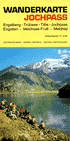
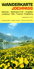
Wanderkarte Jochpass Engelberg - Trübsee - Titlis - Jochpass - Engstlen - Melchsee-Frutt - Melchtal Panoramakarte vierfarbig, Rückseite mit Informationen und topographischer Karte mehrfarbig, beide Karten mit eingetragenen Seilbahnen, 60 x 40 cm, gefaltet auf 10 x 20 cm Faltblatt ohne Angabe eines Herausgebers, Engelberg, 1976 |
|
Engelberg Vogelschaukarte mit Wandervorschlägen / Carte à vol d'oiseau avec propositions d'éxcursions / Aerial map with proposals for excursions 1 Panoramakarte vierfarbig / carte panoramique en couleurs / panoramic map in four-color printing, 8 Abbildungen, davon 2 vierfarbig / illustrations, dont 2 en couleurs / illustrations, from it 2 in four-color printing, 62,6 x 35,2 cm, gefaltet auf / pliée / folded 10,5 x 17,2 cm (mit 4 Abbildungen s/w BET, 1 EB / avec 4 illustrations n/b BET, 1 EB / with 4 illustration b/w BET, 1 EB) deutscher, französischer und englischer Text / intégralité de texte trilingue: allemand / français et anglais / Text in German, French and English Faltblatt / dépliant / leaflet herausgegeben von / éditée par / published by Buchhandlung Franz Hess, Engelberg, ohne Jahresangabe / sans mention de l'an de la parution / without any date of publication |