
|
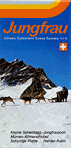
JBH / LSMS Winter Map 23/24 2 panoramic maps, 8 illustrations in four-color printing, 41,5 x 41,8 cm, folded 10,5 x 20,9 cm leaflet published by |
|
|
jungfrau.ch Jungfrau Ski Region Top of Europe · Saison 2017/18 1 Panoramakarte vierfarbig / panoramic map in four-color printing, 17 Abbildungen vierfarbig / illustrations in four-color printing, 51,9 x 27 cm, gefaltet auf / folded 5,7 x 9 cm, unter Kartonschutz / with cardboard cover 6,2 x 9,4 cm (deutscher und englischer Text / text in German and English) Faltblatt / leaflet herausgegeben von / published by |
|
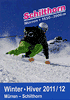
Schilthornbahn Schilthorn Winter · Hiver 2011/12 Mürren - Schilthorn Pistenplan / Carte des pistes / Trail Map Panoramakarte vierfarbig / carte panoramique en couleurs / panoramic map in four-color printing ohne Maßstab / sans échelle / without scale, 30 x 28,4 cm, gefaltet auf / plié / folded 10 x 14,2 cm (Rückseite mit Informationen / le verso avec des informations / reverse with information) herausgegeben von der / publié par / published by |
|
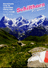
Schilthornbahn Schilthorn Piz Gloria Wanderkarte / Carte de randonnées / Hiking map Panoramakarte vierfarbig / carte panoramique en couleurs / panoramic map in four-color printing ohne Maßstab / sans échelle / without scale, 60 x 42,1 cm, gefaltet auf / plié / folded 10 x 14,2 cm (Rückseite mit Wandervorschlägen / le verso avec des suggestions de randonnées / reverse with proposals of hiking trails) herausgegeben von der / publié par / published by |

|
Bahnen der Jungfrau Region / Railways of the Jungfrau Region Jungfrau Winter 2009/10 Grindelwald-First / Kleine Scheidegg - Männlichen / Mürren - Schilthorn 1 Panoramakarte Winter vierfarbig / winter panoramic map in four-color printing, 7 Abbildungen vierfarbig / illustrations in four-color printing, 29,7 x 41,9 cm, gefaltet auf 10 x 21 cm deutscher und englischer Text / Text in German and English herausgegeben von den / published by the |
|
|
Bahnen der Jungfrau Region / Railways of the Jungfrau Region Jungfrau Winter 2008/09 Grindelwald-First / Kleine Scheidegg - Männlichen / Mürren - Schilthorn 1 Panoramakarte Winter vierfarbig / winter panoramic map in four-color printing, 7 Abbildungen vierfarbig / illustrations in four-color printing, 29,7 x 41,9 cm, gefaltet auf 10 x 21 cm deutscher und englischer Text / Text in German and English herausgegeben von den / published by the |
|
Bahnen der Jungfrau Region / Railways of the Jungfrau Region Jungfrau Winter 2007/2008 Pistenplan | Piste map Grindelwald-First / Kleine Scheidegg - Männlichen / Mürren - Schilthorn 3 Panoramakarten Winter vierfarbig / winter panoramic maps in four-color printing, 13 Abbildungen vierfarbig / illustrations in four-color printing, 41,3 x 72 cm, gefaltet auf 10,4 x 18 cm deutscher und englischer Text / Text in German and English herausgegeben von den / published by the |
|
Schilthornbahn Schilthorn Piz Gloria Wanderkarte / Carte de randonnées / Hiking map Panoramakarte vierfarbig / carte panoramique en couleurs / panoramic map in four-color printing ohne Maßstab / sans échelle / without scale, 60 x 41,9 cm, gefaltet auf / plié / folded 10 x 14,1 cm (Rückseite mit Wandervorschlägen / le verso avec des suggestions de randonnées / reverse with proposals of hiking trails) herausgegeben von der / publié par / published by |
|
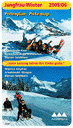
Bahnen der Jungfrau Region / Railways of the Jungfrau Region Jungfrau Winter 2005/2006 Pistenplan | Piste map Grindelwald-First / Kleine Scheidegg - Männlichen / Mürren - Schilthorn 3 Panoramakarten Winter vierfarbig / winter panoramic maps in four-color printing, 12 Abbildungen vierfarbig / illustrations in four-color printing, 41,3 x 72 cm, gefaltet auf 10,4 x 18 cm deutscher und englischer Text / Text in German and English herausgegeben von den / published by the |
|
Mürren / Schilthorn / 1650 - 3000 m ... das Panorame-Wandergebiet im Berner Oberland / ... les plus belles promenades panoramiques de l'Oberland bernois / ... the panorama hiking region in the Bernese Oberland Panoramakarte ohne Maßstab / carte panoramique sans échelle / panoramic map without scale, 19 Abbildungen vierfarbig / illustrations en couleurs / illustrations in four-color printing, 60 x 42 cm, gefaltet auf / pliée / folded 10 x 21 cm (auf der Rückseite Wandervorschläge / les verso avec des propositions de randonnées / reverse with hiking proposals) herausgegeben von der / publié par / published by |
|
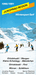
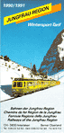
Bahnen der Jungfrau Region / Chemins de fer Région de la Jungfrau / Ferrovie Regione della Jungfrau / Railways of the Jungfrau Region Jungfrau Region 1990/1991 / Wintersport-Tarif Grindelwald / Wengen / Kleine Scheidegg - Männlichen / Grindelwald - First / Mürren - Schilthorn 1 Panoramakarte Winter vierfarbig / carte panoramique d'hiver en couleurs / winter panoramic map in four-color printing, 59,9 x 42 cm, gefaltet auf 10,1 x 21 cm (auf der Rückseite Informationen und 3 Abbildungen vierfarbig / le verso avec des informations et 3 illustrations en couleurs / reverse with information and 3 illustrations in four-color printing) deutscher, französischer und englischer Text / intégralité du texte trilingue: allemand/français/anglais / Text in German, French and English herausgegeben von den / publié par les / published by the |

|
Jungfraubahnen Jungfrau Kleine Scheidegg-Jungfraujoch / Mürren-Allmendhubel / Schynige Platte / Harder Kulm Panoramakarte der Bahnen im Jungfraugebiet ohne Maßstab, 60 x 42 cm, gefaltet auf 10 x 21 cm (auf der Rückseite 18 Abbildungen vierfarbig) herausgegeben von den |

|
Bahnen der Jungfrauregion Jungfrau Region Interlaken / Grindelwald / Lauterbrunnen / Mürren / Wengen / Wilderswil Panoramakarte der Bahnen im Jungfraugebiet ohne Maßstab, 59,8 x 42 cm, gefaltet auf 10 x 21 cm (auf der Rückseite 18 Abbildungen vierfarbig) herausgegeben von den |

|
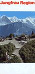
Bahnen der Jungfrauregion Jungfrau Region Grindelwald / Interlaken / Lauterbrunnen / Mürren / Wengen / Wilderswil Panoramakarte Winter der Bahnen im Jungfraugebiet ohne Maßstab, 59,9 x 42 cm, gefaltet auf 10 x 21 cm (auf der Rückseite 23 Abbildungen vierfarbig) herausgegeben von den |
|
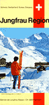
Bahnen der Jungfrau-Region Jungfrau Region Panoramakarte Winter der Bahnen im Jungfraugebiet / panoramic map winter of the railways of the Jungfrau Region / carte panoramique d'hiver des chemins de fer Région de la Jungfrau / carta panoramica d'inverno delle fertovie della Regione della Jungfrau ohne Maßstab, 50 x 42 cm, gefaltet auf / folded / plié / piegato 10 x 21 cm (Legende und Text auf der Rückseite in Deutsch, Englisch, Französisch und Italienisch / legend and reverse with text in German, English, French and Italian / la legende et le verso avec du texte en allemand, anglais, français et italien / legenda ed il dorso con testo in tedesco, inglese, francese ed italiano) (auf der Rückseite 13 Abbildungen vierfarbig / reverse with 13 illustrations in four-color printing / le verso avec 13 illustrations en couleurs / il dorso con 13 illustrazioni a quattro colori) herausgegeben von den / published by / publié par / pubblicato delle |
|
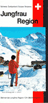
Bahnen der Jungfrauregion Jungfrau Region Panoramakarte Winter der Bahnen im Jungfraugebiet ohne Maßstab, 49,8 x 42 cm, gefaltet auf 10 x 21 cm (Legende in Deutsch, Englisch, Französisch und Italienisch / legend in German, English, French and Italian / legende en allemand, anglais, français et italien / legenda in tedesco, inglese, francese ed italiano) (auf der Rückseite 16 Abbildungen vierfarbig / reverse with 16 illustrations in four-color printing / le verso avec 16illustrations en couleurs / il retro con 16 illustrazioni a quattro colori) herausgegeben von den / published by / publié par / pubblicato delle |
|
Bahnen der Jungfrauregion Jungfrau Region Panoramakarte Sommer der Bahnen im Jungfraugebiet ohne Maßstab, 49,8 x 42 cm, gefaltet auf 10 x 21 cm (Legende in Deutsch, Englisch, Französisch und Italienisch / legend in German, English, French and Italian / legende en allemand, anglais, français et italien / legenda in tedesco, inglese, francese ed italiano) (auf der Rückseite 20 Abbildungen vierfarbig) herausgegeben von den / published by / publié par / pubblicato delle |

|
WAB/JB Jungfrau Region Panoramakarte Sommer der Bahnen im Jungfraugebiet ohne Maßstab, 49,8 x 42 cm, gefaltet auf 10 x 21 cm (Legende in Deutsch, Englisch, Französisch und Italienisch / legend in German, English, French and Italian / legende en allemand, anglais, français et italien / legenda in tedesco, inglese, francese ed italiano) (auf der Rückseite 20 Abbildungen vierfarbig) herausgegeben von den / published by / publié par / pubblicato delle |